In the south Pacific they are called cyclones. In the northern Pacific Ocean they are called typhoons. In the Atlantic Ocean areas they are called hurricanes. One thing is for certain in regard to these phenomenon, they can all be extremely dangerous. The only major difference between all of them is the locations in which they occur. For the purposes of this paper we will refer to the phenomena as hurricanes. The seasons for tropical cyclones vary depending on their location on Earth. Most tropical cyclones form between May to October but in the pacific there have been storms form as early as January.
Get Help With Your Essay
If you need assistance with writing your essay, our professional essay writing service is here to help!
Essay Writing Service
Hurricanes are some of the most powerful weather events on the planet. They can cause millions of dollars in property damage and have the potential to cause the loss of human life on a large scale. These monstrosities, especially in the Atlantic Ocean, can grow to enormous proportions and cover many square miles. These storms usually forms in the tropical regions of an ocean hence the name tropical cyclone. They are fast rotating systems that arecharacterized by low pressure centers, strong winds, and a spiral storms that produce heavy rains. They can produce winds in excess of 155 miles per hour and have been recorded gusting as high as 210 mph. Hurricanes require large bodies of warm water in order to form. There are seven different categories for “hurricanes.” The first category is a tropical depression in which winds are less than 40 miles per hour and there is no formed “eye” of the storm. They also usually lack the spiral shape of stronger storms, however, they are still low pressure systems at this point. The next category is a tropical storm in which winds range from 40 mph to 73 mph. It is at this point when the storm begins to form its spiral shape and winds begin to move in a cyclonic motion. In a few instances the storm has actually formed an eye, although it is usually not very pronounced or developed. The next category is the first stage where a tropical cyclone officially becomes a hurricane or full tropical cyclone. The Saffir-Simpson scale is what is used to determine which one of the following categories a full hurricane falls into. The first is known as a category 1 storm where winds range from 74 mph to 95 mph and the winds can cause slight damage to well built homes and will likely cause power outages due to branches falling on power lines. Category 2 hurricanes have sustained wind speeds from 96 mph to 110 mph. In this category even well-built structures will sustained heavy roof damage as well as possible structural damage. Power loss is almost certain to happen and stay out for days. Category 3 storms are the beginning of what are considered major hurricanes, meaning cyclones that are capable of causing massive damage and high loss of life. They have sustained winds from 111 mph to 129 mph. This is when many trees begin to snap and have the potential to turn into flying debris which can cause a large amount of damage to many of the buildings and windows. A category 4 storm has winds from 130 mph to 156 mph and will cause major damage such as total destruction of a building’s roof and possible full structural collapse. Large loss of life is expected during a storm as powerful as this. The final and most powerful classification of tropical cyclone is a category 5. These monstrosities have winds 157 mph and stronger. Damage should be expected to be widespread and utterly catastrophic. Power lines and other utilities are usually knocked out for weeks on end. This makes many rural areas uninhabitable for a decent amount of time. One of the most powerful storms ever recorded at landfall was Typhoon Haiyan which topped out at over 195 mph. This storm occurred in the Pacific Ocean near the Philippines. The loss of life was enormous killing almost 6300 people in the Philippines alone and as of 2014 they are still finding bodies. Another very powerful category 5 hurricane was Hurricane Andrew which made landfall in Florida as a category 5 and caused over 26 billion dollars in damage. One thing is for sure and that is that a tropical cyclone no matter what the category has the potential to cause major damage and can also cause loss of life. Many people do not heed the warnings when a “smaller” storm is approaching and they get caught in the path and ultimately lose their lives because of it.
This is unfortunate, however, actions can be taken to prevent such things from happening.
In recent years research has shown that with the warming of the earth tropical cyclones have started to produce more rainfall. In the past 100 years it has been determined that the warmer climate will produce an increase of 8% more water vapor for every 1 degree Celsius the temperature increases. More rainfall means a higher potential for flash flooding once the cyclone makes landfall which means more property damage as well as higher risk for loss of life
Cyclone Ita is the most powerful storm to form in the southern Pacific Ocean in three years. The storm began around the Solomon Islands as a tropical depression on April 1st. It finally reached cyclone strength four days later. On the 10th it quickly gained strength to a category 5. It made landfall in the Cooktown/ Cape Flattery area in Queensland Australia on April 12th at 2200 (local time) as a category 4 storm. Upon Ita’s landfall the storm weakened very fast down to a category 1 storm. There was over $1 billion dollars in damage. One building was destroyed and 4 buildings were severely damaged in Cooktown. The damage also included large tracts of sugar cane and a banana plantation was completely destroyed. Cyclone Ita then began to move southeast maintaining gale-force winds the storm accelerated, eventually moving back to the ocean just north of a town called Mackay which is also in Queensland on April 13th. After it moved off of the land and back to the waters off the coast it began to gain strength again as it combined with a low pressure system near New Zealand. It made landfall in New Zealand on the 17th of April and the inner eye wall collapsed which helped to dissipate the storm. The storm brought heavy rainfall and strong winds to the coast before finally destabilizing.
The mitigation efforts taken by each area affected have their similarities as well as some differences. As the storm approached the Solomon Islands the authorities issued severe flood warnings along with cyclone watches. Many facilities in the area prepared for the worst by having backup plans in the event they were required to evacuate. The national hospital actually had to move over 500 patients to other areas due to the flooding that occurred. In Papua New Guinea, the National Weather Service issued tropical cyclone warnings for all island communities. It was decided that all schools and businesses were to remain closed for several days in Milne Bay and many of the residents were encouraged to stay safe indoors. Flooding did occur in this area as well and there was a bridge that was washed away. If the authorities had not issued the warnings to stay indoors and off the roads there may have been many more casualties. In Australia, the authorities issued cyclone warnings to all affected areas in an effort to minimize casualties since the storm was expected to be very strong at landfall. Due to the effectiveness of the pre-mitigation efforts there was minimal casualties. In the aftermath of this and other tropical cyclone events the best way to deal with all of the issues that arise is to have a well-known plan for emergency services as well as power companies. Hospitals should be prepared to receive many casualties like in the event mentioned earlier in the Solomon Islands. Emergency workers such as fire fighters and medical personnel must be available to
Works Cited
“Hurricanes, Typhoons, Cyclones | UCAR – University Corporation for Atmospheric Research.” Hurricanes, Typhoons, Cyclones | UCAR – University Corporation for Atmospheric Research. N.p., n.d. Web. 08 May 2014.
Keegan, Bianca. “Douglas and Cairns Shires on Tropical Cyclone Ita Alert as Storm Deluge Looms.” CairnsPost. N.p., 10 Apr. 2014. Web. 08 May 2014.
National Weather Service. “National Weather Service Weather Forecast Office.” Andrew. N.p., n.d. Web. 08 May 2014.
National Weather Service. “Saffir-Simpson Hurricane Wind Scale.” Saffir-Simpson Hurricane Wind Scale. N.p., n.d. Web. 08 May 2014.
“Queensland Surveys Cyclone Ita Harm.” BBC News. N.p., 12 Apr. 2014. Web. 08 May 2014.
“Tropical Cyclone Ita.” Weather Forecast & Reports. N.p., n.d. Web. 08 May 2014.
“Typhoon Haiyan (Yolanda).” U.S. Agency for International Development. N.p., n.d. Web. 08 May 2014.
Essay Writing Service Features
Our Experience
No matter how complex your assignment is, we can find the right professional for your specific task. Contact Essay is an essay writing company that hires only the smartest minds to help you with your projects. Our expertise allows us to provide students with high-quality academic writing, editing & proofreading services.
Free Features
Free revision policy
$10Free bibliography & reference
$8Free title page
$8Free formatting
$8How Our Essay Writing Service Works

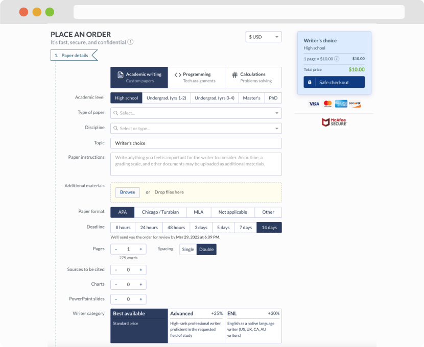
First, you will need to complete an order form. It's not difficult but, in case there is anything you find not to be clear, you may always call us so that we can guide you through it. On the order form, you will need to include some basic information concerning your order: subject, topic, number of pages, etc. We also encourage our clients to upload any relevant information or sources that will help.
Complete the order form
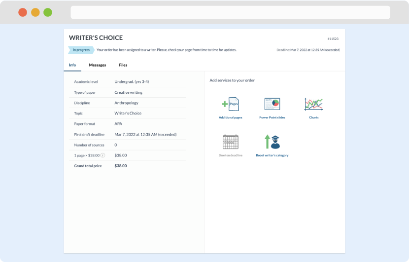
Once we have all the information and instructions that we need, we select the most suitable writer for your assignment. While everything seems to be clear, the writer, who has complete knowledge of the subject, may need clarification from you. It is at that point that you would receive a call or email from us.
Writer’s assignment
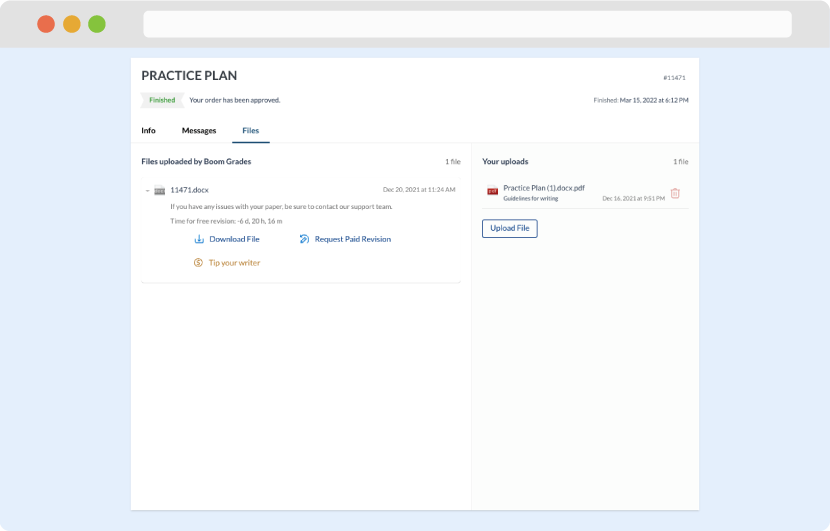
As soon as the writer has finished, it will be delivered both to the website and to your email address so that you will not miss it. If your deadline is close at hand, we will place a call to you to make sure that you receive the paper on time.
Completing the order and download